Valdez and the McCarthy Road
At the end of Part Two I had almost completed the 950-mile round trip from Fairbanks up the Dalton Highway to Prudhoe Bay on the Arctic coast of Alaska. Then my van broke down and I had to be towed the final 56 miles back to civilization.
It could have been much worse - there is a stretch of 239 miles between Coldfoot and Deadhorse with no services whatsoever, no phones, nothing. Even where I ended up, south of Livengood on the Elliott Highway, there is no cell-phone coverage, and precious few places even to safely pull off the road. It was a minor miracle that I managed to roll into a side road with Alaska Pipeline Pump Station Number 7 less than a mile away.
September 5-6-7, 2010I was towed to the comfortable and convenient Super 8 Motel on Airport Way in Fairbanks.
The Northernmost Dennys

The day I broke down was a Sunday, followed by the Labor Day holiday, so it wasn't until Tuesday that I could get my van looked at. I had it towed from the motel to the big well-equipped Cadillac-Chevrolet dealership. I was a little embarrassed to see my mud-encrusted vehicle in their immaculate repair area, but they are used to that up there.
Chevrolet Cadillac of Fairbanks

I was confident that they would be able to fix it and get me back on the road - but at what cost? My wife and I even discussed the worst-case scenario of buying a new vehicle in Fairbanks.
Turns out it was very simple and easy to fix - a broken rotor arm, which had nothing to do with my demanding drive. It could just as easily have happened running errands at home.
September 8-9, 2010When I picked up my van I was given directions to the nearest pressure wash. Normally I never wash my van, but this was pretty extreme. As I drove out of the Chevy dealer's lot I noticed that I had left a rectangular ridge of mud behind.
Before washing
 After washing

I was back on the road and in fine shape, but I had a big decision to make on where to go next. I could head straight south to Denali, or go east then south to Valdez. The weather had been cloudy and rainy all through my stay in Fairbanks and more of the same was forecast. Denali was only a half day away, so the weather was guaranteed to still be bad when I got there. My van is fine for sleeping in, but not much fun for long periods in the cold and rain.
So I headed east through North Pole to Delta Junction, then south on the Richardson Highway.
North Pole, Alaska - did you know that Santa Clause runs an RV park in his off-season?
 A reindeer at North Pole, Alaska

Panoramas east of Fairbanks
It rained steadily that day, all night, and the next morning. By the time I got to the Tok Cutoff at Glenallen I was ready to give up on Alaska and head for home. But luckily I didn't, because the bad weather was about to break, and some of the best days of the trip lay ahead.
Camping in the rain

The Richardson Highway passes through the Alaska Range, of which I saw nothing because of the weather, then just west of the Wrangell Mountains (also invisible), and finally through the Chugach Range and out to the coast on Prince William Sound. Despite the weather it was a beautiful drive, with fall colors reaching their peak and a lot of wildlife - a lynx crossed the road in front of me early in the morning.
Richardson Highway in the rain

Panoramas of the Gulkana River
The visitor center for Wrangell-Saint Elias National Park near Copper Center had a very encouraging weather report - clearing then sunny for the next week. Sure enough, the clouds had lifted high enough to give me some dramatic views as I passed over the Chugach Range.
Glaciers from the highway at Thompson Pass

Valdez is a major fishing port (and smells like it), but is famous mostly as the terminus for the Alaska Pipeline. I toured that facility in 2000, but it has been closed to the public since "911".
The town was surprisingly busy and I had trouble getting a room so had to take a slightly more expensive cabin. It was well equipped and comfortable, and I had a great dinner at the Valdez Bistro. I decided to take the boat tour on Prince William Sound the next day no matter what the weather,
September 10, 2010This day I took the Stan Stephens Glacier Cruise around Prince William Sound. It started out densely foggy, but cleared just in time to give us a look at the Anderson Glacier waterfall. After that it was clear all day.
Prince William Sound waterfall
 Tankers taking North Slope oil to California

Around another point or two we turned into the bay that heads in the Columbia Glacier, one of the larger and more active tidewater glaciers in Alaska. The terminus was miles away but we circled around in the floating ice for an hour. Some of the icebergs were an amazing shade of blue.
Floating ice from the Columbia Glacier in Prince William Sound.
 An exceptionally blue iceberg.

From the Columbia Glacier we steamed around to the south side of Glacier Island and followed a pod of orcas (killer whales). Though not really set up for wildlife photography I got some passable shots and some short movies.
An orca in Prince William Sound
 Steller sea lions hauled out on a rocky shelf.

In addition to the glaciers, floating ice, and wildlife, the scenery in Prince William Sound is stunning. My main disappointment was that it was impossible to take 360-degree panoramas from the crowded bow of the boat. But that opened up the possibility of an entire day of simple single-shot photography - so much less demanding and more fun than panography.
Islet in Prince William Sound.
 Fishing boat near Valdez.

Panoramas of Prince William Sound (only the first two are from this trip)
September 11, 2010In the morning I explored around Valdez a bit, then headed north.
Panoramas of Valdez (first four from this trip)
Pink and chum salmon spawning in Crooked Creek.

There isn't much left of Old Valdez. It was damaged in the earthquake and tidal wave of 1962, then the town was relocated to its present site. There is a good view across the bay to the Alyeska Pipeline Terminal. It was interesting to watch the tide coming in and rise an inch during the time it took me to shoot just one pano -- I started on dry gravel and ended in the water.
Remains of the waterfront boardwalk street in Old Valdez

A little further out of town a road leads to the small lake at the terminus of the Valdez Glacier. Of all the desperately dangerous routes to the Klondike gold fields this had to be the worst - right up the glacier to the divide, then many miles more to the Copper River. In the winter it was rigorous, but in summer it was deadly as the snow melted and crevasses opened up. An alternate route through Keystone Pass and over Thompson Pass was soon pioneered, and eventually followed by the Richardson Highway, Alaska's first permanent road from the coast to the interior.
Panoramas East of Valdez
The drive northwards through Thompson Pass was spectacular, perfect weather. Local people were out picking berries and just lying around in the sun. I stopped (again) at the Worthington Glacier. It used to extend past the viewing area and there was a trail along its lateral moraine, but it has retreated so far that now the ice terminus is beyond a small lake.
Berry pickers near Thompson Pass

Panoramas of Thompson Pass
All through the trip I had been frustrated by the difficulty of finding viewpoints that were not blocked by trees and taking panoramas are not mostly highway. On the north side of the Chugach Mountains I found a unique solution -- I waded across a beaver-created marsh, and stood on their dam to take my pano.
Panoramas of the Chugach Range on the Richardson Highway
At the end of the day I headed east to the tiny historic town of Chitina and camped next to the mighty Copper River.
Welcome to Chitina

Panoramas of Chitina
September 12, 2010Chitina is where the gravel McCarthy Road starts and runs 60 miles east through Wrangell-Saint Elias National Park. It was a beautiful morning's drive, though the thick forest blocked distant views much of the time.
Early morning fog over the Chitina River
 The McCarthy Road, another 120 miles of gravel

I have a problem with heights and exposed places such as swinging bridges and cliff-tops. I am able to overcome it - I have climbed some serious mountains and stood on the brink of Half Dome. But I knew there was a famously scary bridge over the Kuskulana River on the McCarthy Road, and I had been dreading it for precisely 6094 miles.
The Kuskulana Bridge was built in 1910 for the Copper River Railway and abandoned when the mine shut down, but local people continued to use it. It was narrow, barely wide enough for a pickup truck, and had no guardrails. It is 525 feet long and 238 feet above the river. A few years ago The Milepost noted that half the deck boards were rotted away and missing.
I know I could not have crossed it back then, I would have been frozen at the wheel. The current edition of The Milepost notes that it has been rebuilt and guardrails added, but that many people still find it scary.
Then suddenly, there it was. I held my breath and drove across without hesitation, 5 mph, eyes glued to the far end. Once done it was no longer intimidating and I walked back to the middle and took a pano. On the way back the next day I even shot a handheld movie as I drove.
Kuskulana River Canyon and Bridge
 The greatly improved Kuskulana Bridge
 Another high timber trestle, over the Gilahina Rover
 Fall color on the McCarthy Road
 Mount Blackburn from the McCarthy Road

Panoramas of the McCarthy Road
The McCarthy Road ends at the Kennecott River, just short of McCarthy, so you have to walk across (just a few years ago you had to use a self-propelled cable tram).
The new footbridge over the Kennecott River

McCarthy is a picturesque little town, a mere shadow of its prime when miners came down from Kennecott to raise hell on Saturday nights. Now it provides services for the huge national park, and is the setting for several of Dana Stabenow's Kate Shugak murder mysteries.
Ma Johnson's Hotel in McCarthy

Panoramas of McCarthy
I rode the shuttle bus up alongside the moraine-covered glacier to the company town, mill, and mines at Kennicott.
The Kennecott Cooper Mine MIll rises up the mountainside above town

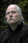
It was the last day for tours, and I was the only one to sign up, so I got a one-on-one tour (again!). My guide, Nealy, was able to accommodate my special needs so I got a few intriguing panoramas inside the huge mill building.
There is a great view from the top of the mill building
 Don and Nealy in "the brewery" at the Kennecott Mill
 Looking back at at the Kennecott Mill from the north end of town

Panoramas of Kennicott
Panoramas of the Kennecott Mine Mill
Back at the end of the road I drove into a private campground and found that the owner and his buddies were closing it for the season by eating and drinking everything that was left in the store. They had just finished the beer, after six hours of steady effort.
So I was the last camper of the year. It was immediately cold when the sun went behind the mountain, a clear night with brilliant stars, and I heard wolves howling.
Don in camp at McCarthy

September 13, 2010The next day, returning along the McCarthy Road the fall colors were even more spectacular. The air was still and the lakes reflected like giant mirrors.
Long Lake on the McCarthy Road

I stopped to look at the fish wheels on the Copper River. Powered by the current they scoop unsuspecting salmon right out of the silty river. Not very sporting, it is only for natives with traditional rights. The smell of rotting fish was truly amazing.
Fish wheels on the Copper River at Chitina

The fine weather allowed me to re-shoot some views of the Wrangell Range from viewpoints south and north of the historic settlement of Copper Center. These are volcanoes, eroded, dormant, and active, up to 16,000 feet high. I spent the rest of the day circling around their west and north sides.
Quaking aspen near Copper Center
Panoramas of Copper Center
September 14, 2010This was a very long day of driving, along the Tok Cutoff and then back on the Alaska Highway, enlivened by spectacular foliage colors and clear views of the glacier-covered Wrangell Mountains to the south.
Mount Sanford from near Slana on the Tok Cutoff
 Trumpeter swans in the Tetlin Refuge
Panoramas of the Tok Cutoff
Panoramas of Tetlin National Wildlife Refuge
I crossed back into the Yukon at Port Alcan, and camped a few miles later near Snag Lake.
September 15, 2010Another long drive that began with many miles of severe frost heaves. The colors of the cottonwoods, aspen, and birch were outstanding and there was a series of beautiful lakes - Moose Lake, Pickhandle Lake, and huge Kluane Lake.
Reflection in Pickhandle Lake
Panoramas of the Alaska Highway in the Western Yukon
Panoramas of Kluane
The official viewpoints of the spectacular Icefield Ranges in Kluane National Park failed to provide me with a good unobstructed view - they had let trees grow up thirty feet tall right in the way.
On a hunch, I pulled into an unpaved side road, many of which lead to gravel pits. It was narrow and a bit muddy, so I walked it instead of driving, and in a quarter mile it did indeed end at a small gravel quarry on a glacial moraine running along the side of a broad valley, with a staggering range of peaks on the far side.
Score! The weather was perfect - on the 36th day of the trip, I had to rate it as the best view yet.
The Icefields Ranges from the north
 Willow-covered flats north of the Icefields Ranges

I had planned to spend the night in a motel in Whitehorse, but there was some sort of First Nations conclave going on and the town was full. So I camped a few miles further on, cold but peaceful.
September 16, 2010Another full day on the Alaska Highway. I stopped at the impressive Teslin Tlingit Heritage Center on long Teslin Lake and bought a few distinctive Indian handicrafts as presents.
Clan totems at the Teslin Tlingit Heritage Center
 Tanker truck in Teslin equipped with a "moose-catcher"

Panoramas of Teslin
That night I stayed in a motel in Watson Lake. Strange to tell, there was a very noisy honky-tonk bar next door, most of the patrons of which appeared to be First Nations/Native Americans/Indians. Also, although the town did not have cell-phone service, the high-speed internet was excellent.
The story concludes with
Don's Trip to the Far North - Part Four