I haven't posted to this blog in six months and people have asked whether I am still actively developing the site. The answer is yes, emphatically YES, Don Bain's Virtual Guidebooks will be growing and evolving faster than ever in the next year! Let me catch up now with news and plans for the future.
First, a very major change in my life. After a year of increasing dissatisfation I left my job at the University of California (after 22 years), effective July 1. The new Geography department chairman's idea of what my job should be was completely different than mine, and was unacceptable to me. So I quit. Technically, I retired, so I have a guaranteed income and benefits - but the wonderful thing is that now I have full time to devote to my other projects.
Of course the first thing I did with my new freedom was to hit the road. Since April (when I made the decision and started using up vacation time) I have taken six long photography trips, which I will describe below. I plan to stay at home during November and December (just a few short trips) to catch up on the pictures I have taken, develop the web site, and reinvigorate the World Wide Panorama.
Soon after I left the university the department chair broke his promise to continue to sponsor the World Wide Panorama by providing a free server. It was not too much of a surprise -- he hadn't kept his other promises either, and we were prepared. Landis Bennett and I (co-founders of the WWP) had already set up a non-profit corporation, the World Wide Panorama Foundation, to take over responsibility for the project. There is a lot of work to be done, but I see a bright future for this international collaboration and showcase for VR photography. The first appearance of the new WWP will be the "Best of 2008" event, appearing January 1, 2009.
The trips I have been taking will add almost a thousand new VR panoramas to the Virtual Guidebooks site. But before I sketch out where I went and what I saw, let me mention the behind-the-scenes changes being made to the site.
When I initiated Virtual Guidebooks in late 1999 all I knew was html, so the site was built that way. It got less and less reasonable to maintain in this form (handcrafted static html pages) as it grew to a thousand panoramas, then two thousand, then I added fullscreen versions, and growth continued to its present 6000. The result has been increasing lag time in getting new panoramas up on the site, a lack of flexibilty in page design and contents, and an awful lot of work to make changes or additions.
The modern solution of course is to convert to a database-driven model. So I am currently creating a whole new version of the site with PHP and MySQL, learning as I go. It is slow and at times tedious, but also interesting -- and every bit of progress is exciting. I dare not predict when the project will be complete, or even whether the conversion will be in stages or all at once. But I will discuss it in some future blog post.
Spring Break in March, when I was still acting like an employee, was spent mostly in the Mojave Desert. No special wildflower displays this year, but it gave me a very welcome chance to think about my future, and escape from the unpleasant situation developing at work. Expect over a hundred new panos of East Mojave National Preserve, Laughlin and Oatman on the Colorado River, and Valley of Fire State Park near Las Vegas.
I managed another week-long trip in late April, catching the end of wildflower season in the South Coast Ranges and revisiting areas along the central coast and El Camino Real in Monterey, San Luis Obispo, and Santa Barbara counties. An easy, pleasant trip, with time to work on some new techniques. Another hundred new panos.
I took off half of May for a long trip through the spectacular parklands of the Colorado Plateau in Utah - Capitol Reef, Canyonlands, Natural Bridges, and the Kolob Canyons of Zion. I took about 150 panoramas, most of which are finished but will probably not be posted to the site until the big database project is further along.
My most ambitous trip, one I have been planning for a long time, took most of the month of July. I followed the Oregon Trail eastwards (i.e. backwards) from Salt Lake City all the way to Independence, Missouri, focusing on history and rural landscapes. This was mostly new country for me, including nearly two weeks in Nebraska. I liked it a lot, but let me warn you that camping there in the summer requires an air-conditioned motorhome with screened windows!
Actually, I was following the intertwined routes of the Oregon Trail, Mormon Trail, California Trail, the original transcontinental railroad, and the Pony Express. I saw a lot of old wagon ruts, many modest frontier buildings, scenery that was less spectacular than further west, very nice small towns and just two cities (Omaha and Salt Lake). On the way back I toured the Black Hills of South Dakota, another state new to me. In all I shot almost 400 panoramas!
I took barely a week to recover then headed north for the last trip of the summer. First a few days in Redwood National Park (one of my very favorite places), then up the Oregon Coast and inland to Portland. Another 150 panos.
Most of September slipped by while I was distracted with health issues, a major home repair project and similar mundane concerns. But I managed one more trip, a mid-October quest for fall color.
I have been to Zion Canyon when it was just unbelievable - in addition to the always-colorful sandstone, there were brilliant yellow cottonwoods and aspen, orange Gambel oaks and red canyon maples. So I headed for Utah. But I found everything still green in Zion, too early by almost a month, and the aspens at Cedar Breaks already bare, a week too late.
It was a great trip nevertheless. In addition to Bryce Canyon and Cedar Breaks I spent a day at Great Basin National Park in Nevada, hiking in the bristlecone pine forest at 10,000 feet, then drove diagonally across the sparsely inhabited heart of Nevada from Ely to Tonopah. Finally three days in Owens Valley (with some fall color) and a day in the White Mountains shooting still more ancient bristlecone pines.
So keep checking this blog and this site for major changes. My goal is to have the databased version of Virtual Guidebooks launched and all this summer's panos up by the end of 2008.
Wednesday, October 29, 2008
Wednesday, May 7, 2008
Updates to the Northern California Coast
The Virtual Guidebook to the Northern California Coast and North Coast Ranges covers everything between the Sacramento Valley and the coast, from Arcata south to the northern edge of the Bay Area. Its unifying features are the redwood forests and the dramatic coastline.
When I first started arranging my VR panoramas into "guidebooks" (regions) back in 1999, the area covered by each one was much smaller than now. Through a process of gradual amalgamation, this guidebook evolved from earlier separate guidebooks for Eureka, the Redwood Highway, the Lost Coast, the Mendocino Coast, the Sonoma Coast, and the North Coast Ranges. Maybe I have overdone it - there are now 47 localities with 251 panoramas .
In November I made a trip to update the sections on Fort Bragg and Mendocino, and in January/February did the same for Eureka, Shelter Cove, and Sinkyone. There are still some areas up there that I want to fill in or update (notably Arcata), and the stretch of coast from Mendocino to Salt Point needs a lot of new panos. I want to hike the Lost Coast again, both the northern (Mattole River to Shelter Cove) and southern (Sinkyone Wilderness) stretches, and climb King Peak.
The Redwood Highway section needs to be completely redone, and supplemented with Headwaters Forest and Grizzly Creek. I currently have nothing at all from the higher coast ranges (Yolla Bolly, Snow Mountain) or the Clear Lake area, nor from the beautiful vineyard valleys of the upper Russian River. So this guidebook is far from complete.
Here's a review of the new additions to this guidebook.
Samoa is an old company town, formerly the property of the Hammond Lumber Company. Now it is famous mostly for the Samoa Cookhouse (standard size or fullscreen), but most of the old buildings are still in good shape and there are plans for redevelopment. It is located on North Spit, site of some big industrial properties and a long stretch of dunes and beach.
Eureka is one of the under-appreciated small cities of California. There is the commercial port and a newly developed waterfront. The impressive historic section known as Old Town is rivalled only by Port Angeles in Washington and Old Sacramento. Downtown Eureka boasts some fine old buildings and a vibrant arts scene.
Ferndale is a true gem of a small town, a Hollywood favorite (Outbreak, The Majestic). I managed to reshoot it in the last hour of winter daylight.
The Lost Coast Headlands are something new, recently acquired by the BLM and opened to the public. This is a notoriously unstable bit of coast and one stretch of road dropped down 400 feet a few years ago. It could be a new and vital link in the California Coastal Trail, which now goes far inland here.
Shelter Cove is an isolated development in the middle of the Lost Coast. Laid out by real estate developers in the 1960's, it features an airstrip, golf course and campground, a few motels and small stores, and a scattering of houses with more under construction. Its wild and lonely location makes it worth the long winding drive over the coast ridges from Highway 101 at Garberville.
I photographed the old Cape Mendocino Lighthouse ten years ago in its original location by trespassing, so it was nice to see it restored and relocated to the park in Shelter Cove (standard size or fullscreen). Also of note is the Black Sands Beach just north of town.
Sinkyone Wilderness State Park is one of my personal favorites. I made a special trip there in February and was blessed with a sunny day followed by a foggy day, both with 15-20 foot waves. The northern section, Whale Gulch, is pictured here in the fog, a very common condition.
The center section of the park features the old Needle Rock Ranch. I was fortunate to be able to walk right through the herd of Roosevelt elk that lives there (standard size or fullscreen) on my hike back from Whale Gulch. I camped at Barn Camp (that's my van parked by the barn, my tent in the trees standard size or fullscreen) and spent an hour shooting the sunset from the clifftops (standard size or fullscreen) and (standard size or fullscreen).
From Needle Rock a dirt road leads south to Bear Harbor. My favorite shot here was taken on a dangerously unstable cliff edge above the roaring surf (standard size or fullscreen).
The last day of that February trip I started to work my south along the Mendocino coast starting at Westport, but the bone-chilling fog quickly discouraged me. I will pick it up again at Cleone and McKerricher, maybe next fall.
The famous and very interesting central Mendocino coast has already been covered in this blog (see Weekend Trip to the Mendocino Coast).
Fort Bragg and its port, Noyo, get better all the time, making a long transition from the old economy of timber and fisheries to a new one of tourism and art. Mendocino itself (properly Mendocino City, but nobody calls it that) is widely recognized from movies and television and well established as a venue for art. Actually, most of the artists now live elsewhere, notably in Fort Bragg.
Back in November I also managed to photograph a few places in the coast ranges inland from Mendocino, the pygmy forest and Albion River, and one of my favorite redwood groves, Montgomery Woods. I used one of the redwood pictures as my entry in Best of 2007 on the World Wide Panorama site.
Though I took them over a year ago, some panos of Sonoma Coast State Park and Bodega Bay have only just been added to the site. And finally, a token few shots of the wine valleys, specifically Boonville and Anderson Valley.
Monday, May 5, 2008
Redwoods in the Fog - the Print
For over two years now I have been making slow deliberate progress towards selling panoramic prints of the images on my Virtual Guidebooks site. My wife has had several of them framed and hung them at home, and I have shown a number at lectures and art fairs. A later blog post will announce availability and give details when my fine art panoramic prints are ready for sale.
Most of the prints I have made so far are straighforward wide-format panoramas, usually the complete 360°. They have an interesting distortion, a unique form factor, and people seem to like them. Since I draw them directly from the 6000+ archive of Virtual Guidebooks images the range of subjects and locations is enormous - something for everyone.
But some of my most dramatic VR panoramas are cubics, which pose special problems for printing as flat media. Here is the story of how I dealt with this challenge for one of these (from the Virtual Guidebook to Redwood National Park) - be sure to look straight up:
- Huge trees and chest-high ferns in the Lady Bird Johnson Grove. (6-19-04)
- Standard Size or Fullscreen Size
The original photos were taken near the dedication site in the Lady Bird Johnson Grove, Redwood National Park, California. A foggy day was chosen both for the soft even lighting and because of the close ecological relationship between the coastal fog zone of northern California and the geographic range of the redwoods.
Some of the trees here are over 300 feet tall (100 meters) and 10 feet diameter (3 meters). Visitors to old growth redwood groves are struck by the cathedral-like quality of the forest and the majesty of the amazingly tall straight trees. Although over 90% of the original redwood forest has been logged, many of the finest groves are preserved in national and state parks.
Below the massive redwoods (Sequoia sempervirens) grow tanbark oaks (Lithocarpus densiflorus), California rose bay (Rhododendron macrophyllum), salal (Gaultheria shallon), and sword fern (Polystichum californicum).
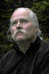
In its print form I call it simply "Redwoods in the Fog". After printing it a few times at home I made a larger print (60 by 30 inches) on the big Epson 9800 at my computer lab. Here I am posing with the final mounted print on the balcony at the Geography department, UC Berkeley.

This striking image began with a series of 37 separate photographs. They were taken with carefully controlled geometry using a tall tripod and a special camera mount. Because of the shoulder-high sword ferns the camera, a Nikon d100 digital SLR, was held about seven feet (2.1 meters) above the ground.
Here the original photos are shown arranged in three tiers, plus a zenith (straight up) shot. There is no nadir shot (straight down) because the dense vegetation made it impossible for me to step out of the way.

Using a special computer program (PTGui) the individual frames were warped and overlapped, then blended, to form a continuous image that covers an entire spherical view. Image procesing programs such as Photoshop can only deal with a rectangular matrix of pixels, so the spherical image was reprojected and saved as an equirectangular image – twice as wide as high, equivalent to an unprojected world map (known as plate carée).

This equirectangular image was then processed into a digital movie file. This uses a cubic imaging model, so the equirectangular image is reprojected to six cube faces.

Viewing software allows the user to direct the view in any direction, unwarping the image in real time for a realistic geometry. This is what you see on the web site.
Note how the equirectangular image completely fails to convey the impression of great height that is so striking in the interactive version, and also when you are there in the redwood forest itself. To approach this ideal on a flat surface a distortion of the spherical image is needed, a problem similar to that of map projections.
First I explored traditional map projections. The Mercator projection results in straight and parallel tree trunks, but it is unable to show the zenith – just as a Mercator world map cannot show the poles.
Other map projections gave interesting results, but my final choice was a filter designed to make fisheye lens images rectilinear. The “de-fished” panorama shows all the way from the photographer’s toes to the zenith high above in the fog, with an interesting outwards bowing of the straight tree trunks.

Another way to display a spherical image is to project it to a series of facets which can then be cut out, folded, and assembled into a three dimensional display. It is shown below as a “philosphere”, with square and triangular faces.

I would like to do this on a large scale so it could be viewed from inside. A philosphere would be simple, but the more facets the closer it would be to reality. The hole at the bottom is where I was standing when taking the pictures (the missing nadir shot).
If this polyhedron were large enough, and lit translucently from outside, the viewer could stand up through the hole and receive a realistic impression of being in the redwood forest.
Updates to Redwood National Park
The Virtual Guidebook to Redwood National Park covers that magical far corner of California from Trinidad north to the Oregon border. It isn't just the national park (which is actually a composite of national and state park lands) as it includes Crescent City, several small towns, a number of state parks and some national forest.
This was one of the first areas that I set out to cover methodically, and hence has a large proportion of older panoramas (before 2000). These were shot on negative film and although the photographic quality is high, the scanning process did not produce true colors and sharp images. Maybe someday I will take the time to re-scan so I can produce first-rate panos, but my immediate plan is to re-photograph these areas whenever I have the opportunity. This is no real hardship, as I love visiting this area.
Starting at the northwest end (my usual way of ordering geographic contents) we come first to Crescent City - and a lot of old panoramas. These will stay until I can get back up there for rephotography. The older film-based panos are instantly recognizable by their smaller thumbnail images, and the absence of a fullscreen version.
The "Redwood National and State Parks" begin just outside Crescent City, with Jedediah Smith Redwoods State Park on the Smith River. A major part of this park is on Mill Creek, which can be seen to advantage from the Howland Hill Road, an unpaved one-laner which has hardly changed since stage-coach days. The Boy Scout Tree Trail leads from this road through some of the most magnificent forest on earth, home to a number of world champion trees.
I have a lone pano from the Smith River Recreation Area - a favorite destination of mine in pre-panography days. I need to get back there to document the beautiful South Fork of the Smith River, the historic Kelsey Trail, and the unique geology and botany.
Del Norte Redwoods State Park spills down the high bluffs south of Crescent City. Hiking the Damnation Creek trail down to the coast here has been high on my "to do" list for years. More rephotography is needed at Klamath and the north end of Prairie Creek Park.
Prairie Creek Redwoods State Park is considered one of the crown jewels of the California state park system. Though I visit it almost every year I still don't have a good set of panoramas, partly because I am often with a class (see my blog comments on panography and the field class). But no excuses - I need to make it a high priority to photograph Elk Prairie and its resident elk, plus the amazing redwood forests.
Prairie Creek park spans from the sheltered valley of the creek across low ridges to the coast at Gold Bluffs Beach. The incomparable Fern Canyon is hidden here in the coastal bluffs.
For the second-ever World Wide Panorama event the theme was World Heritage, and Redwood National Park is a UNESCO listed world heritage site. I made a weekend trip and got some great photos. The one I used for the WWP site was taken on the Boy Scout Tree Trail as a full spherical image - but I didn't have time to create it as a cubic pano for the event. I have done so subsequently (standard size or fullscreen). This was also the trip where I captured one of my best panoramas ever (standard size or fullscreen), in the fog and huge ferns of the Lady Bird Johnson Grove.
My memories of Orick and Redwood Creek go back to high school, when I made one of my first solo trips to the newly created Redwood National Park. It was truly an adventure, including three days spent camping alone at the Tall Trees Grove. I repeated the hike a few years later with my sister and a group of college friends - by that time intensive logging was taking place all around the park perimeter. Given that personal history, I really need to produce a better series of panos, retracing my hike up the creek to the Tall Trees. Next summer - I promise.
The Humboldt Lagoons are a lovely string of freshwater lakes, drowned valleys cut off by barrier beaches. With the exception of Big Lagoon I haven't done them justice. I have always wanted to boat across Stone Lagoon to the primitive campsites on the far side.
I did manage to update my Patricks Point panos with a trip this last January - normally the north coast is not a prime destination in winter, but I was very lucky with the weather. I was particularly glad to be able to shoot a new series of the re-created Yurok Indian village of Sumeg, built within the park by Yuroks and park staff. My old panos have been very popular over the years, especially with school kids studying Native Americans.
Finally we come to Trinidad, a delightful little town with a harbor and lighthouse, beach and pier. My panoramas continuing south from here can be found in the Virtual Guidebook to the Northern California Coast (currently being revised).
Another big update to the Redwood National Park guidebook will probably be forthcoming next fall, after my summer trips.
Monday, March 10, 2008
New Panoramas of Oregon
With two years of catching up to do, this update increases the number of panoramas of Oregon on the site from 257 to 375. Let me tell you about it guidebook by guidebook.
The Oregon Coast:
In June of 2006 I finished my long trip to the northwest with a couple of days on the southern Oregon coast. I came over the mountains from Corvallis to Newport on Yaquina Bay, then worked my way south. There are new panoramas in the following localities: Newport, Alsea Bay and Yachats, Heceta Head, Cape Blanco, Port Orford, Rogue River, and Boardman State Park.
My favorites are one taken late in the day at Whaleshead Beach (standard size or fullscreen), and a scene with local people crab fishing by the big bridge at Yaquina Bay (standard size or fullscreen).
Portland and the Columbia River Gorge:
I have added several new views of Oregon City, including the John McLoughlin House National Historic Site. See the Oregon City localities, upper and lower. This was the first incorporated city in the west, along with many other firsts, and was the official end of the Oregon Trail.
In the Columbia Gorge section I added some much-needed spherical shots of waterfalls, such as Latourelle (standard size or fullscreen) and Multnomah (standard size or fullscreen). There are new panos in every locality except Bonneville Dam, just start at Crown Point and work your way east. I particularly like this shot of Wah Gwin Gwin Falls at the Columbia Gorge Hotel (standard size or fullscreen).
The Willamette Valley and Southern Oregon:
New panos of historic Champoeg (the birthplace of American Oregon), Canyonville, Grants Pass, and the Cascade-Siskiyou National Monument near Ashland. Once again I had to skip Salem because of a lack of time - but next year for sure.
The Oregon Cascades:
In July 2007 I spent a week in the Oregon Cascades, enjoying a long day hike in the Marion Lake area, another day seeing waterfalls and forests on the upper McKenzie River and Willamette Pass Highway, plus the dramatic lava fields of McKenzie Pass.
I planned to spend two days on Mount Hood, but had to cut it short when heavy smoke from a fire on the Warm Springs Indian Reservation cut visibility and made breathing difficult. All I managed to see before beating a trategic retreat was Timberline Lodge. But there was an unexpected bonus - it was Smokey the Bear's birthday, and he posed for a picture with me (standard size or fullscreen) (Smokey is the one on the left).
I also finally got around to taking the boat tour at Crater Lake. The views of the lake from the rim drive viewpoints are beautiful (standard size or fullscreen), but the lake level perspective is very different (standard size or fullscreen).
Only two tours a day go to Wizard Island, which I have always wanted to visit, so I had to get up early to stand in line (no reservations taken). We only had two hours on the island, just enough time to hike to the top of the cinder cone, around the rim, and have lunch. Fast-moving clouds made panoramic photography difficult, but it was a very satisfying day's outing. Recommended. My favorite shot features one of the silvery snags on the crater rim (standard size or fullscreen).
Eastern Oregon:
In summer 2007 I targeted a few previously overlooked areas east of the Cascades. First, the lower John Day River and John Day Fossil Beds National Monument, Painted Hills unit and Sheep Rock unit. I particularly like an other-worldly shot of the boardwalk at Painted Cove (standard size or fullscreen).
Back closer to the mountains, I documented the charming town of Sisters, including one of my periodic personal appearances, in a delightful campground in the ponderosa pine forest east of town (standard size or fullscreen). Further south, I added a few shots from Newberry National Volcanic Monument and the interesting area around Fort Klamath.
There are a lot more panoramic opportunities waiting for me in Oregon and I plan to visit there every year. I need to revisit the Kalmiopsis area in the southwest corner and Smith Rock near Bend. I love the river canyons on the west slope of the Cascades, and need to get back to the alpine meadows on Mount Jefferson when they are summer green and flowery. The Oregon coast always beckons, and I need better panos of the Seaside/Cannon Beach area, and the Cascade Head preserve.
But most importantly I need to spend a few days concentrating on the charming city of Portland. It was on my itinerary in both 2006 and 2007, but got rained out both times.
On My Way to Leadville
Sometimes I end up spending more time along the way than at my planned destination. On my Colorado Rockies trip last summer (June 28 to July 10), out of thirteen days on the road I only spent two in the Rockies, and on one of those it rained all day. But it was a successful trip nonetheless, improvising and exploring as I dodged bad weather and major forest fires. I ended up shooting a lot of places from my list - just not the ones that I had planned on, and have added new panoramas to no less than eight guidebooks.
My first night was spent at Pyramid Lake on the Paiute Indian Reservation north of Reno. You can camp almost anywhere along the west shore of the lake (though there are no facilities) and I was able to find a spot on a bluff top with no other campers nearby. So this trip began with a night of magnificent solitude (standard size or fullscreen), a great sunset, then an even better sunrise (standard size or fullscreen). Better entertainment than any casino-hotel in Nevada, as far as I am concerned.
Then I hit the highway and spent most of the day crossing Nevada to Salt Lake City. I had planned to revisit Temple Square and drive out to Antelope Island to camp, but the heat was oppressive and the air was polluted with smoke from forest fires, so I ended up in a motel.
But the day after that was great. First a couple of historic Mormon towns: the railroad town of Ogden; then Brigham City with the nearby Bear River Wildlife Refuge on the northern arm of the Great Salt Lake. The Salt Lake is a closed basin and in wet years the lake level rises, in dry cycles it recedes. There is an impressive new visitor center (standard size or fullscreen) , replacing one that was flooded out a few years ago.
Late in the afternoon I got to Golden Spike National Historic Site. I expected not much more than a plaque out in the middle of nowhere (the railroad bypassed this area many years ago). To my amazement, when I got there I found the two historic locomotives standing on the tracks, nose to nose as in the famous photographs (standard size or fullscreen). They are replicas, very faithful ones, and had steam up ready to roll. You can stand on the tracks between them, directly over where the golden spike was driven (standard size or fullscreen). I barely had time to take a few different views, when they announced that the locomotives were going back to the train shed. So I hustled a mile down the tracks and shot them as they steamed past (standard size or fullscreen).
Some of the places I shoot are completely fortuitous, I just stumble upon them, or I see something intriguing on a map. It said "Thiokol Missile Exhibit" on the map near Golden Spike so I made a slight detour to check it out. It turned out to be a missile fuel facility, closed to the public, but with an impressive array of (dummy) missiles in front of the office building (standard size or fullscreen). It's a company with an interesting history.
Finding a cool and pleasant place to camp that night turned out to be a challenge and I ended up heading east into the Wasatch Range. I was pulled over by a state trooper for going 75 in a 50 mph zone as I came down the grade towards Logan. He let me off, presumably because I claimed (with total honesty) to have been distracted by the beauty of the view.
The next morning I went up to Tony Grove Lake (standard size or fullscreen), north of Logan Canyon, named for the "tony" local elite who used to camp there. Then I followed the Bear River from Bear Lake (standard size or fullscreen) south all the way to its source on the north side of the Uinta Mountains, ending with the Mirror Lake Scenic Byway. Nice lakes and meadows but the most dramatic parts of the range are remote from any roads and not easily viewed.
There was a huge forest fire burning in the eastern Uintas, with smoke blowing east - right towards where I was heading next. So I poked around the southwest corner of Wyoming for a couple of days. Fort Bridger is a fascinating bit of history (standard size or fullscreen), maintained as a state park. To camp I drove south to China Meadow in Wasatch-Cache National Forest, an area popular with locals and practically unknown to the outside world (standard size or fullscreen).
Evanston, Wyoming is an interesting old railroad town (standard size or fullscreen), which will be even more so when they finish restoring the locomotive roundhouse. This is rolling sagebrush country, thinly settled, with the original route of the trans-continental railroad running through it (standard size or fullscreen). Fossil Butte National Monument is famous for its fossil quarry and has an excellent visitor center, but what I enjoyed most was the road up to the mesa top (standard size or fullscreen).
Then south once again into Utah, the forest fire still burning, but the smoke blowing elsewhere. Flaming Gorge National Recreation Area was a surprise. I expected a red rock canyon(standard size or fullscreen), but not the adjacent high country (standard size or fullscreen). To get around the gorge the road climbs through miles of beautiful forest with extensive views (standard size or fullscreen), then drops dramatically to the Green River .
Next major stop was Dinosaur National Monument. The canyon of the Green River was scenic (standard size or fullscreen), but the famous dinosur quarry was closed for rehabilitation, and the heat was intense. Some miles east I took a road that heads north from the tiny town of Dinosaur into the monument's backcountry, Another beautful high mesa (standard size or fullscreen), ending with a short hike to a dramatic viewpoint above Echo Park (standard size or fullscreen), the junction of the Green and Yampa Rivers. I badly wanted to drive down to the river, but was feeling pressed for time - this was my Colorado Rockies trip, after all, and it was more than half over, with the Rockies not yet in sight.
On the way back to Dinosaur I saw lightning strike repeatedly in the flatlands below, then a column of smoke. It is not often that you actually see lightning start a fire (I phoned it in). I drove eastwards through rolling country, stopping for a great sunset (thanks to all the fires), then camped on the Yampa River in the eastern part of the monument (standard size or fullscreen).
The next day I finally reached the Rockies at Steamboat Springs, where it began to rain, and continued all day and night. But the next day the weather was clear and I made a loop through some of the best of the Colorado Rockies. First through the Eisenhower Tunnel on Interstate 70, then back over the top on Loveland Pass (standard size or fullscreen) and down past the Arapahoe ski resort (standard size or fullscreen).
West on the interstate again for a while, then south to Leadville (standard size or fullscreen). A very impressive and well preserved old mining town, free of the condo and resort development that has spoiled so many places in Colorado. Leadville was especially meaningful as I had just been reading Wallace Stegner's masterpiece Angle of Repose (Penguin Twentieth-Century Classics), a signficant part of which takes place there.
From Leadville I crossed the headwaters of the Arkansas River (standard size or fullscreen) and headed west again, into the Sawatch Range and over Independence Pass (standard size or fullscreen) to Aspen. I had intended to put some effort into documenting this interesting area, butAspen was just too crowded and busy and I couldn't handle it.
Seeking a high cool place to camp I headed west and ascended Grand Mesa. This is an amazing and little known feature, a huge plateau of high country with desert all around. I spent the next morning exploring its little lakes in flowery meadows (standard size or fullscreen), and spruce forests (standard size or fullscreen).
The Lands End lookout (standard size or fullscreen) was a CCC project, as was the road that zig zags up from the desert. A drunk driver had run off the road just below the lookout (standard size or fullscreen). The south side of Grand Mesa has a cluster of deep glacial lakes in forest (standard size or fullscreen) and there are some beautiful aspen groves (standard size or fullscreen).
But the day wasn't over yet. On the way to my motel in Grand Junction I made the loop drive through Colorado National Monument. Some prime red rock scenery (standard size or fullscreen) but the air was smoky and the light just wasn't good. At Cold Shivers Point a young woman was sitting on the cliff edge past the railing, feet dangling over the vertical drop, staring at her cell phone. I wondered if she was planning to jump, and if I should say something. But she didn't, and I saw her driving away a little later, so there was no drama after all.
My trip was almost over so I headed west on the interstate, with a short side trip to the petroglyph site in Sego Canyon (standard size or fullscreen) and road-side views of the San Rafael Swell country (standard size or fullscreen). It was smoky everywhere, but got much worse as I approached Salina. Sure enough, dozens of big fires were raging ahead and traffic was backed up for miles. Over a hundred miles of Interstate 15 had been closed and I had to detour down the old highway along the Sevier River. But it worked out okay - I camped at Cedar Breaks National Monument that night (standard size or fullscreen).
This put me far from from my original route, and fires were still burning to the north. So I headed across Nevada on the Extraterrestrial Highway, stopping at the Little A'le Inn (standard size or fullscreen) for a beer (standard size or fullscreen). That night I camped very comfortably in the Jeffrey pine forest east of Mono Lake (standard size or fullscreen).
So, the trip to the Colorado Rockies was kind of a bust, but on the way there and back I saw: Pyramid Lake, Ogden, Brigham City, Golden Spike, Thiokol missiles, Logan, the Uintas, Fort Bridger, Evanston, Fossil Butte, more Uintas, Flaming Gorge, Dinosaur, Echo Park, Grand Mesa, Colorado National Monument, Cedar Breaks, and the Extraterrestrial Highway. Not so bad, after all.
New Panoramas of Mount Shasta and Mount Lassen
The volcanic northeast corner of California is one of my favorite camping and hiking destinations. I swing through every year in the fall with my field class (see below) and often tarry a day or more on my way north to Canada in the summer. Over the last two years I have taken a number of new panoramas scattered around these two guidebooks, and now finally have them posted to the site.
Early summer of 2006 I explored upstream along the upper Klamath River from the Interstate 5 crossing - new country to me. Some beautiful landscapes (standard size or fullscreen), and of especial interest because of the controversy over two hydroelectric dams that block salmon and steelhead migration. We may well see the removal of Iron Gate Dam (standard size or fullscreen) in the next decade. Restoration of the fishery would be wonderful, though we would also lose these beautiful high desert reservoirs (standard size or fullscreen).
Upstream even further I had a look at the Klamath Wildlife Refuges and the agricultural town of Tulelake, center of the upper Klamath basin water crisis in dry years.
On my way to Canada in August 2006 I spent most of a day documenting the very complete and interesting company town of McCloud, just a few miles east of Interstate 5 on the south slopes of Mount Shasta. Controversy here, too, over a proposed huge bottling plant for natural spring water.
Lassen Volanic National Park is a gem, but a difficult one to visit because the road is blocked with snow for so long into the summer. My wife and I made a long weekend camping trip there in late July 2006 and I filled in some of the major sights.
Manzanita Lake is the classic postcard view of Mount Lassen (standard size or fullscreen). Lake Helen records some of the heaviest snowfall in the world, and true-to-form was still frozen the last day of July (standard size or fullscreen). We didn't have time to hike to Bumpass Hell (my panos of which are very old and need to be replaced), but the Sulphur Works is a smaller version, and right on the main road (standard size or fullscreen).
Puget Sound Updated
On my many trips north through Washington to Canada I always seem to be rushing along Interstate 5 and missing the interesting places just a bit off to the side. So in 2006 I slowed down and explored. First the old port district of Bellingham known as Fairhaven - where a jazz concert was taking place (standard size or fullscreen). Then south on Chuckanut Drive (standard size or fullscreen), which follows the steep shore of Puget Sound where I-5 goes inland. Then a few hours in the picturesque waterfront village of La Conner (standard size or fullscreen), over the Rainbow Bridge (standard size or fullscreen) and on to Deception Pass, (standard size or fullscreen) one of my favorite Northwest camping spots.
In 2006 I spent just one day walking around Seattle. I could only cover the downtown area and part of the waterfront, plus a quick visit to Pike Place. I really need to devote a week to Seattle some time (maybe summer of 2008), so I can begin to do justice to this beautiful city.
In late July last summer I spent a few days wandering around the Kitsap Peninsula and the San Juan Islands (plus the Olympia Peninsula, as noted here). The weather was superb, which is not always the case up there.
I was charmed by the Port Orchard area, near Bremerton. Further north I visited the pseudo-Norwegian town of Poulsbo (standard size or fullscreen), the restored historic town of Port Gamble (standard size or fullscreen), and the lighthouse at oddly named Point No-Point (standard size or fullscreen).
San Juan Island itself was wonderful, with the historic legacy of the Pig War at English Camp in the north (standard size or fullscreen) and American camp in the south (standard size or fullscreen). Plus the lighthouse at Lime Point (standard size or fullscreen) and some very nice countryside, including a lavender farm (standard size or fullscreen).
A beautiful ferry ride (standard size or fullscreen) took me to Orcas Island where I camped at Moran State Park, the gem of the Washington park system. The ranger urged me to drive immediately to the top of Mount Constitution to enjoy the exceptionally clear evening. I did, and it was worth it (standard size or fullscreen). I went back the next morning (standard size or fullscreen). The tower here was built by the CCC.
Also on Orcas Island - beautiful lakes in Moran park (standard size or fullscreen), mariculture in Ship Bay (standard size or fullscreen), the elegant Rosario Resort (standard size or fullscreen), and charming little harbors scattered around (standard size or fullscreen), before I had to return to the ferry dock (standard size or fullscreen) and head back to the mainland. I was due at my niece Sarah's wedding in two days, in Vancouver, and could not be late as I was to perform the ceremony!
On my way home, after the wedding, I spent a few hours in the interestng town of Centralia. It is the only town in Washington (or so far as I know the entire West) to be founded by an African American - named George Washington (standard size or fullscreen). It is also noted for a violent clash between the International Workers of the World (IWW - or "wobblies") and the American Legion, in 1919, known to history as the Centralia Massacre. Centralia has a well preserved downtown district (standard size or fullscreen) and a number of interesting murals (standard size or fullscreen). I also managed to photograph Amtrak passing through (standard size or fullscreen).
These additions brought the number of panoramas in the Virtual Guidebook to Seattle and Puget Sound from a pathetic 60 to a reasonably respectable 165. In summer of 2008 I hope to spend some time in Seattle, maybe make a day trip over to Bremerton, revisit Tacoma, and poke around the southern Sound.
Tuesday, February 12, 2008
New Panoramas of the Olympic Peninsula
New: The Virtual Guidebook to the Olympic Peninsula, Washington
Today I posted a new edition of my virtual guidebook to the Olympic Peninsula in Washington state. There are now 112 panoramas (up from 83). I have replaced some very old panos taken on negative film a decade ago with new high resolution cubics (so you can look straight up and down). Compare one of the the old ones to a new version (standard size or fullscreen) taken in almost the same location.
I had several days of beautiful weather in August 2007 when I revisited the north side of Olympic National Park - great new images of Lake Crescent, the forest at Marymere, and Hurricane Ridge. My favorite was taken from the end of the pier at Crescent Lake Lodge, with a rustic bench offering serene views in two directions (standard size or fullscreen).
Then a cloudy day gave me perfect conditions to shoot the Hoh Rain Forest. There are rain forests in each of the major west-facing valleys on the peninsula (Sol Duc, Bogachiel, Hoh, Queets, and Quinalt), but the Hoh is the most famous by far. Two short loop trails from the visitor center at the end of the road show off the Hall of Mosses area with its bigleaf maples, and the towering Sitka spruce rain forest.
I'm not nearly done with the Olympic Peninsula. Most importantly, I hope to backpack up the Queets River again to photograph its superb wilderness rainforests. My wife Nora and I did this years ago (before I started taking panoramic photos) with her sister Barbara and brother-in-law Mike, who have been hiking it annually for many years. Mike grew up in nearby Hoquiam, and the Queets is his family's special place - we even met two of his cousins while hiking there. One of the allures of the Queets is the small number of people, largely due to the fact that the trail begins with an often daunting ford of the river. Once across there are miles of nearly flat trail through prime Sitka spruce forest, maple and alder groves, with good camping on the river bars.
I have other high priority destinations on my Olympic trip planning list. When I was still in high school I hiked (alone) up the Hoh River all the way to the Blue Glacier on Mount Olympus, an adventure I hope to repeat. And as a waterfall fancier (see my site Waterfalls of Western North America) I have always wanted to visit the Enchanted Valley. This is a lush steep-sided valley high up on the Quinalt River, a two day hike from the roadhead. It has glacier and snow-fed waterfalls all along the valley walls, and is sometimes called the "Valley of a Thousand Waterfalls". I also have always wanted to backpack the wilderness coast of Olympic National Park and I need to revisit Cape Flattery on a non-foggy day. And finally, I hope to explore some of the short steep valleys on the east side of the Olympic Mountains above Hood Canal.
Sunday, February 3, 2008
Finally, Some VR Panoramas of Colorado
New - Virtual Guidebook to the Colorado Rockies
I am based in Berkeley, California, and there are practical limits to how well I can cover the huge region encompassed by the Virtual Guidebooks. Colorado is right out on the edge of my area, an 18 hour drive from the Bay Area to Denver. Also, being mountainous, many areas are best visited only in the summer (unless I start doing ski resorts and snowshoe routes). So I have been a bit slow in building my coverage of this beautiful state.
My first effort was in May 2006 when I drove across the San Juan Mountains, through Ouray and Silverton. Great scenery and interesting towns - but too early in the year for the high altitudes - I will have to go back in mid-summer.
In the summer of 2007 I made another effort to photograph the Colorado Rockies. My initial itinerary, to include Wyoming, the Dakotas, and the high plains, was just too much driving for the time available. So I decided to concentrate on the central Rockies, plus two days in Denver. Even that didn't work out - bad weather and forest fires - so I never made it to Rocky Mountain National Park, or to Denver.
I really had only one day in the central Rockies, so I made a loop over Loveland Pass to Leadville, then across the headwaters of the Arkansas River to Independence Pass. Then I had to start home. Maybe next summer...
(NOTE: a future blog will tell the whole story of "On My Way to Leadville", but first I need to finish all the panoramas used to illustrate it.)
Greatly Expanded - Virtual Guidebook to Western Colorado
Many people are unaware of how much of Colorado is desert, some of it the sort of red rock country we associate with Utah. It is closer to my home base than the Rockies, and the weather is better, so I now have pretty good coverage.
Some of my earliest digital photography was done at Mesa Verde National Park in May 2000. It is a fabulous place to do VR panoramas, but problematic. There are crowds of people, and most of the ruins can only be toured as part of a group. Doing VR with a crowd of 70 people is just about impossible, the panos end up being about the people, not the ruins. The only way to do it right is to hire an off-duty ranger to give you a personal tour - I may try it out some day.
In 2006 I spent a day down in the Four Corners area investigating the scattered sites of Hovenweep National Monument (Hovenweep's main site and the monument headquarters are across the state line in Utah).
On my trip in summer 2007 I added a lot to this guidebook: the Harpers Corner Road in the eastern part of Dinosaur National Monument, the upper Yampa River, Colorado National Monument, the high country of Grand Mesa, the Land O'Lakes on the south side of the mesa, and the Black Canyon of the Gunnison National Park.
I plan to return to Colorado in summer of 2008, and hope to visit Aspen, Rocky Mountain National Park, Denver, Colorado Springs, and Great Sand Dunes National Monument.
Subscribe to:
Posts (Atom)