In October 2009 I attended the joint meeting of the IAPP and the IVRPA (International Association of Panoramic Photographers and International VR Photography Association) in Albuquerque, New Mexico. It was great fun and I enjoyed meeting people with obsessions similar to my own. I gave a talk entitled "Why 360-degree VR?"
Since Albuquerque is only a thousand or so miles from home, I decided to drive both ways and do a little photography on the way. I plotted a zig-zag course connecting up places I felt I needed panos of, either to fill in gaps in my coverage, or to replace ones that were old and/or not so good. I ended up taking 259 panoramas on the trip, and all but the last 50 or so are now finished and published on my website.
-
My first day took me to Needles, where I frequently camp at Moapa Regional Park on the Colorado River. From there I crossed into Arizona and followed the river down through Lake Havasu City (home of London Bridge), the Parker Strip and the Colorado River Indian Reservation where I added another of the WWII Japanese Relocation camps to my list. I spent the night in another of my favorite camp areas, the "long term visitor area" for snowbirds at Quartzsite. I intended to laze around there for a day or two, but the wind picked up and made it impossible - everything from my hat to my flip-flops started blowing away!
Southern Deserts and Cactus Country
-
Central Arizona
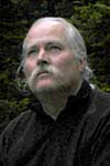
I relocated to a motel in Verde Valley, which has grown remarkably since I was last there, and the next day shot panos around the historic town of Prescott, formerly the territorial capital, and home to the excellent Smoki Museum. From there it was over the mountains to the old mining town of Jerome. The old Jerome High School has been converted to artists studios and galleries, a excellent idea and a most pleasant place. The picture I took of artist Mark Hemleben in his studio was the one I ended up using for my Best of 2009 on the World Wide Panorama site. Also in the Verde Valley I re-shot Tuzigoot and Montezuma Castle National Monuments.
Northern Arizona
After a surprisingly cold night camping near Flagstaff (down to 17 degrees), I revisited Sunset Crater National Monument, with its colorful volcanic cones and black lava flows. Heading east on Route 66 (now Interstate 40) I documented a stretch of the old road at Winona (scroll to the bottom of the Flagstaff page). Remember that line in the song - "Flagstaff Arizona, don't forget Winona"? It must have been for the rhyme, there has never been anything very memorable there. My last stop before the state line was Barringer Meteor Crater, truly one of the wonders of the world. It deserves to be a national monument, but remains in private hands, and I must say they do an excellent job of both preserving and protecting it. The next day was a straight shot into Albuquerque for the conference.
Pueblo Country
The conference was held during the Albuquerque International Balloon Festival. We had prime seats at the Gondola Club to view the sunset spectacle of the special shapes balloons, followed by the "Glowdeo" of balloons illuminated by the propane flames that provide their hot air. Unfortunately a traffic accident trapped me on the freeway the next morning and I missed the mass ascencion. Another activity at the conference was a trip on the aerial tram to the Sandia Crest.
I came down with a cold, or maybe flu, the last day of the conference, and spent most of the next four days in a cheap motel in Belen, New Mexico, staring at the ceiling. When I recovered I headed southeast to rephotograph the Salinas Pueblos National Monument, also known as "the cities that died of fear". First was Abo, thick walls of a ruined church with a pueblo around it and a kiva inside the cloister walls. Then Quarai, massive red sandstone ruins on a verdant hillside. Finally, a long drive east onto the plains, where Gran Quivira (also known as Las Humanas, crowns a low ridge with ash grey stone ruins, a Spanish pueblo village built on top of a radial prehistoric structure.
Southern New Mexico
Next I spent a day exploring east of the Rio Grande Valley to the Very Large Array radio-telescope complex on the Plains of San Augustin, then the old mining town of Magdalena. The railroad was built to here because of mines such as the Kelly Mine, and was the destination for massive cattle drives from the interior plains of New Mexico as recently as 1948. I explored historic Socorro, which was founded in 1598 by Don Juan de Onate, and that night I camped at Water Canyon in the Socorro Mountains, The next day I drove around Bosque del Apache National Wildlife Refuge then headed back to Albuquerque Pueblo Country Again
There is a genuinely historic and interesting district known simply as Old Town surrounding the plaza in Albuquerque. My attempt to panograph other parts of the town was frustrated by a Sunday morning charity run event that had all the streets blocked. Instead I took a hike in the Rinconada Canyon section of Petroglyph National Monument, notable mostly for the extreme proximity of new development and a lot more joggers and dog walkers than petroglyphs. Next time I will go to the Boca Negra section, apparently much more impressive.
The rest of the day was spent at Bandelier National Monument, an amazing prehistoric site with traditional pueblos on the floor of Frijoles Cayon plus unique dwellings built into the soft volcanic rock of the canyon wall. The weather was perfect and it was swarming with people hiking the short trail and climbing up and down the ladders and in and out of the caves. On the way back I stopped at the Rio Grande viewpoint in White Rock near Los Alamos .
Starting home the next day I spent most of the day at El Malpais National Monument, where pale sandstone ciffs edge a huge black lava field. That night I enjoyed a bit of history by staying at the El Rancho Hotel in Gallup on old Route 66.
Northern Arizona Again
Just at the New Mexico-Arizona state line I headed north to Window Rock, the Navajo nation capital. Nearby is Hubbell Trading Post National Monument, managed by the National Park Service as a combination historic site and active trading post. From Hubbell I drove north to Chinle and shot a quick series of panos along the south rim of Canyon de Chelly, then spent the night in the lovely (free) campground located in a stand of cottonwood trees.
From Williams I went north to the South Rim of the Grand Canyon. I have never been fond of the South Rim, too much development and too many people. It wasn't as bad as in mid-summer, but was still not, in my opinion, the optimal way to enjoy this wonder of the word (I recommend Toroweap if you want to really experience the Grand Canyon.)
I worked my way along the busiest stretch of the canyon rim, from Mather Point to Yavapai Point, the canyon rim lodges, Lookout House and Kolb's Studio, and Grand Canyon Village. Despite the grandeur and beauty of the views, it felt more like work than pleasure to me.
Southern Deserts Again
Back in California I headed northwest to the mining town of Trona on Searles Lake, then north up Owens Valley and home over Sonora Pass. There were some good fall colors along the east side of the Sierra, but I have not put them up yet.
No comments:
Post a Comment